![](/images/other/stat-length.png)
![Tour Wandern Le Muy - VALLÉE DE L'ENDRE - CASCADE DU GOURNIE - Photo](https://media.geolcdn.com/t/1900/400/ext.pjpeg?maxdim=2&url=https%3A%2F%2Fmedia.geolcdn.com%2Ff%2Ff51b539b-86a7-4814-af1d-5cd810042a23.jpg)
VALLÉE DE L'ENDRE - CASCADE DU GOURNIE
jean-marie.parachini
Benutzer
![Länge](/images/other/stat-length.png)
Länge
7,5 km
![Maximale Höhe](https://static1.geolcdn.com/siteimages/upload/files/1508320355ic_sort_altitude_max_24dp.png)
Maximale Höhe
66 m
![Positive Höhendifferenz](https://static1.geolcdn.com/siteimages/upload/files/1508320355ic_sort_den_pos_24dp.png)
Positive Höhendifferenz
76 m
![Km-Effort](/images/other/stat-length.png)
Km-Effort
8,5 km
![Min. Höhe](https://static1.geolcdn.com/siteimages/upload/files/1508320355ic_sort_altitude_min_24dp.png)
Min. Höhe
33 m
![Negative Höhendifferenz](https://static1.geolcdn.com/siteimages/upload/files/1508320355ic_sort_den_neg_24dp.png)
Negative Höhendifferenz
76 m
![Boucle](https://static1.geolcdn.com/siteimages/upload/files/16400158638029165_repeat_loop_refresh_sync_direction_icon.png)
Boucle
Ja
Erstellungsdatum :
2022-11-10 08:13:29.698
Letzte Änderung :
2022-11-10 17:29:34.596
![Wandern](https://static1.geolcdn.com/sitytour/trail-icons/101.png)
8h58
Schwierigkeit : Sehr leicht
![Scannen Sie diesen QR-Code, um die Tour in der SityTrail-Anwendung zu öffnen](https://capi.geolives.com/qq0zvz2zws4bq2lad0pu/sitytour/trails/3452455/qr.png?size=200)
Kostenlosegpshiking-Anwendung
Über SityTrail
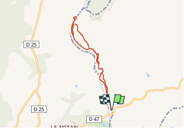
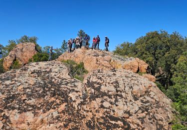
Tour Wandern von 7,5 km verfügbar auf Provence-Alpes-Côte d'Azur, Var, Le Muy. Diese Tour wird von jean-marie.parachini vorgeschlagen.
Beschreibung
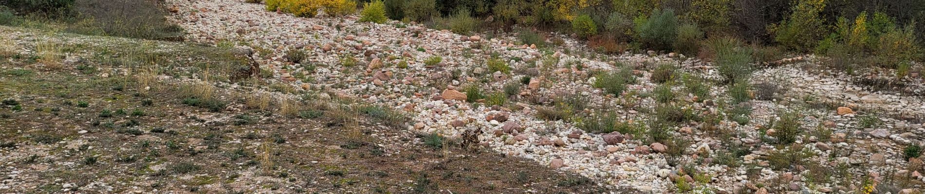
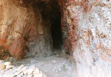
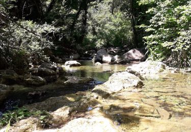
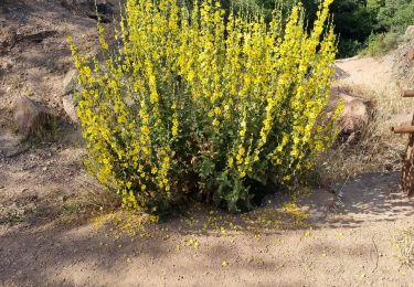
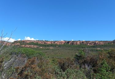
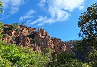
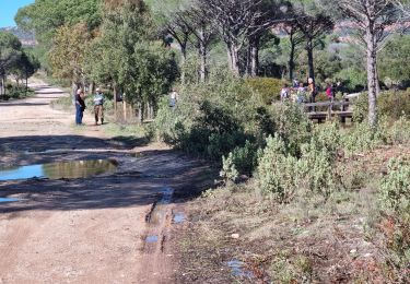
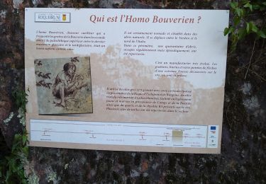
randonnée facile par la forêt domaniale de la Colle du Rouet en suivant la vallée de l'Endre jusqu'à la cascade du Gournié.
Ort
Land:
France
Region :
Provence-Alpes-Côte d'Azur
Abteilung/Provinz :
Var
Kommune :
Le Muy
Standort:
Unknown
Gehen Sie:(Dec)
Gehen Sie:(UTM)
305244 ; 4819651 (32T) N.
Kommentare
Touren in der Umgebung
![Tour Wandern Le Muy - les grottes Baume Renaude - Photo](https://media.geolcdn.com/t/375/260/ext.jpg?maxdim=2&url=https%3A%2F%2Fmedia.geolcdn.com%2Ff%2F83f6db30-c43d-4bf1-a9a3-011d52f73567.jpg)
![Wandern Wandern](https://static1.geolcdn.com/sitytour/trail-icons/101.png)
les grottes Baume Renaude
Wandern
Schwierig
(1)
Le Muy,
Provence-Alpes-Côte d'Azur,
Var,
France
![](/images/other/stat-length.png)
13,3 km | 18,3 km-effort
5h 13min
![](https://static1.geolcdn.com/siteimages/upload/files/16400158638029165_repeat_loop_refresh_sync_direction_icon.png)
Nein
![Tour Wandern Callas - gorge de Penafore - Photo](https://media.geolcdn.com/t/375/260/ext.jpg?maxdim=2&url=https%3A%2F%2Fmedia.geolcdn.com%2Ff%2F19f2f069-7b40-4577-819a-e6663f6d8c61.jpg)
![Wandern Wandern](https://static1.geolcdn.com/sitytour/trail-icons/101.png)
gorge de Penafore
Wandern
Sehr leicht
(1)
Callas,
Provence-Alpes-Côte d'Azur,
Var,
France
![](/images/other/stat-length.png)
1,1 km | 1,3 km-effort
1h 33min
![](https://static1.geolcdn.com/siteimages/upload/files/16400158638029165_repeat_loop_refresh_sync_direction_icon.png)
Ja
![Tour Wandern Roquebrune-sur-Argens - z le Blavet 18-06-24 - Photo](https://media.geolcdn.com/t/375/260/ext.jpg?maxdim=2&url=https%3A%2F%2Fmedia.geolcdn.com%2Ff%2Fe512df93-efb4-4004-aaca-047b2c27de15.jpg)
![Wandern Wandern](https://static1.geolcdn.com/sitytour/trail-icons/101.png)
z le Blavet 18-06-24
Wandern
Medium
Roquebrune-sur-Argens,
Provence-Alpes-Côte d'Azur,
Var,
France
![](/images/other/stat-length.png)
6,2 km | 7,6 km-effort
2h 4min
![](https://static1.geolcdn.com/siteimages/upload/files/16400158638029165_repeat_loop_refresh_sync_direction_icon.png)
Ja
![Tour Wandern Le Muy - Le Rouet Vignes - Photo](https://media.geolcdn.com/t/375/260/ext.jpg?maxdim=2&url=https%3A%2F%2Fmedia.geolcdn.com%2Ff%2F3e0e2443-a7af-4ef6-9005-77227526ad06.jpg)
![Wandern Wandern](https://static1.geolcdn.com/sitytour/trail-icons/101.png)
Le Rouet Vignes
Wandern
Medium
Le Muy,
Provence-Alpes-Côte d'Azur,
Var,
France
![](/images/other/stat-length.png)
8,2 km | 9,9 km-effort
2h 52min
![](https://static1.geolcdn.com/siteimages/upload/files/16400158638029165_repeat_loop_refresh_sync_direction_icon.png)
Ja
![Tour Wandern Roquebrune-sur-Argens - La Bouverie - Gorges du Blavet - Grotte du Muéron - Photo](https://media.geolcdn.com/t/375/260/ext.jpg?maxdim=2&url=https%3A%2F%2Fmedia.geolcdn.com%2Ff%2F867aec0a-5e80-4bc3-a435-de9966de7428.jpg)
![Wandern Wandern](https://static1.geolcdn.com/sitytour/trail-icons/101.png)
La Bouverie - Gorges du Blavet - Grotte du Muéron
Wandern
Einfach
Roquebrune-sur-Argens,
Provence-Alpes-Côte d'Azur,
Var,
France
![](/images/other/stat-length.png)
7,9 km | 11,3 km-effort
2h 27min
![](https://static1.geolcdn.com/siteimages/upload/files/16400158638029165_repeat_loop_refresh_sync_direction_icon.png)
Ja
![Tour Wandern Le Muy - 2024-04-17_09h53m25_visorando-2024-04-19-les-roches-de-la-fille-isnard-gilles - Photo](https://media.geolcdn.com/t/375/260/ext.jpg?maxdim=2&url=https%3A%2F%2Fmedia.geolcdn.com%2Ff%2F5a621cd3-9532-4383-9ace-ccf70fe1b0c2.jpg)
![Wandern Wandern](https://static1.geolcdn.com/sitytour/trail-icons/101.png)
2024-04-17_09h53m25_visorando-2024-04-19-les-roches-de-la-fille-isnard-gilles
Wandern
Medium
Le Muy,
Provence-Alpes-Côte d'Azur,
Var,
France
![](/images/other/stat-length.png)
16,6 km | 23 km-effort
5h 16min
![](https://static1.geolcdn.com/siteimages/upload/files/16400158638029165_repeat_loop_refresh_sync_direction_icon.png)
Ja
![Tour Zu Fuß Roquebrune-sur-Argens - 2024-03-12_16h48m05_Randonn_e-44 - Photo](https://media.geolcdn.com/t/375/260/ext.jpg?maxdim=2&url=https%3A%2F%2Fstatic1.geolcdn.com%2Fsiteimages%2Fupload%2Ffiles%2F1545311037marcheuse_200dpi.jpg)
![Zu Fuß Zu Fuß](https://static1.geolcdn.com/sitytour/trail-icons/100.png)
2024-03-12_16h48m05_Randonn_e-44
Zu Fuß
Einfach
(1)
Roquebrune-sur-Argens,
Provence-Alpes-Côte d'Azur,
Var,
France
![](/images/other/stat-length.png)
11,6 km | 16,2 km-effort
3h 41min
![](https://static1.geolcdn.com/siteimages/upload/files/16400158638029165_repeat_loop_refresh_sync_direction_icon.png)
Ja
![Tour Wandern Le Muy - z le trou de la Jarre 12-03-24 - Photo](https://media.geolcdn.com/t/375/260/ext.jpg?maxdim=2&url=https%3A%2F%2Fmedia.geolcdn.com%2Ff%2F19c5cc5b-c18d-431f-8b04-443a299b25e3.jpg)
![Wandern Wandern](https://static1.geolcdn.com/sitytour/trail-icons/101.png)
z le trou de la Jarre 12-03-24
Wandern
Einfach
Le Muy,
Provence-Alpes-Côte d'Azur,
Var,
France
![](/images/other/stat-length.png)
7,3 km | 8,3 km-effort
2h 32min
![](https://static1.geolcdn.com/siteimages/upload/files/16400158638029165_repeat_loop_refresh_sync_direction_icon.png)
Ja
![Tour Wandern Roquebrune-sur-Argens - LA BOUVERIE / grottes /malvoisin/église des paiens/muerons - Photo](https://media.geolcdn.com/t/375/260/ext.jpg?maxdim=2&url=https%3A%2F%2Fmedia.geolcdn.com%2Ff%2Fda85eaf4-4832-4d6a-bf98-1691801a435f.jpg)
![Wandern Wandern](https://static1.geolcdn.com/sitytour/trail-icons/101.png)
LA BOUVERIE / grottes /malvoisin/église des paiens/muerons
Wandern
Medium
Roquebrune-sur-Argens,
Provence-Alpes-Côte d'Azur,
Var,
France
![](/images/other/stat-length.png)
12,2 km | 17,5 km-effort
3h 59min
![](https://static1.geolcdn.com/siteimages/upload/files/16400158638029165_repeat_loop_refresh_sync_direction_icon.png)
Ja